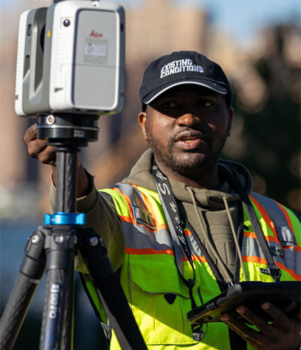
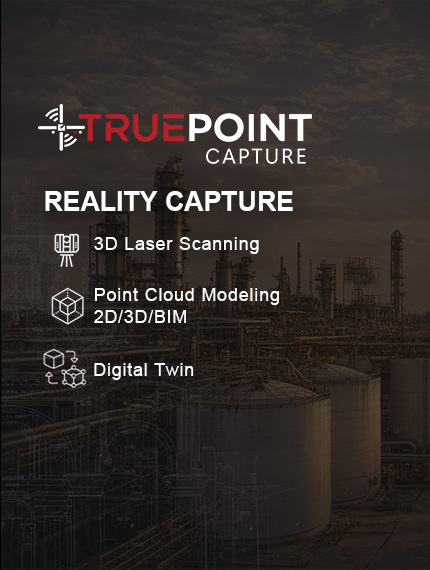
TruePoint Capture
3D Laser Scanning & Reality Capture

Supporting design, construction, and asset planning across Nigeria with millimetre-accurate spatial data

Precision Reality Capture for Critical Assets

TruePoint Capture is Insightful3d’s specialized reality capture and spatial data arm, delivering high-accuracy
3D laser scanning, photogrammetry, and digital site documentation for infrastructure, oil & gas, industrial, and large-scale construction projects.

What We Deliver

We provide end-to-end reality capture services that transform physical environments or assets into accurate digital representations for planning, inspection, retrofitting, and asset lifecycle management.

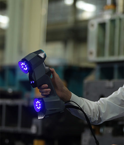
Core Services include:

  • 3D Laser Scanning (LiDAR)
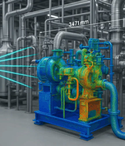
  • Reality Capture for Oil & Gas Facilities
  • Industrial & Infrastructure Site Scanning
  • As-Built Documentation
  • Point Cloud Processing & Registration
  • Scan-to-CAD / Scan-to-BIM
  • High-Fidelity Digital Twins for Visualization & Analysis

Industries We Serve

We help asset owners, engineers, and project teams see, measure, and plan with confidence, using reliable spatial data captured to millimetre-level precision. Our services are focused on projects across Nigeria.

  • Oil & Gas (Onshore & Offshore Facilities)
  • Power & Energy Infrastructure
  • Industrial Plants & Factories
  • Transportation & Civil Infrastructure
  • Construction & Engineering Projects
  • Asset Owners & Facility Managers

Why TruePoint Capture

We provide accurate reality capture and spatial data that enables asset owners, engineers, and project teams to plan, design, and execute with confidence.

Data captured with industry-grade scanners and proven workflows

Outputs compatible with CAD, BIM, GIS, and digital twin pipelines.

We partner with local and international collaborators to ensure fast, accurate, and reliable project delivery.

Shape Image

Our 3D Laser Scanning Services

When your project depends on accuracy, speed, and certainty, our 3D laser scanning
solutions help eliminates assumptions and costly errors before they happen.

Scan-to-BIM

Conversion of point cloud data into coordinated BIM models for design development, clash detection, and construction planning.

Industrial & Plant Scanning

High-detail scanning of oil & gas facilities, power plants, mechanical rooms, processing equipment and pipework

Digital Twin & VR Integration

Laser scan data used to create Interactive digital twins, VR walkthroughs, virtual inspections and training environments.

Architectural & MEP Scanning

Precise capture of building interiors and exteriors, structural elements, mechanical, electrical, and plumbing systems

How We Add Value

TruePoint Capture turns raw site data into dependable decision tools. By delivering accurate, well-structured spatial information, we help project teams reduce uncertainty, shorten decision cycles, and manage assets with confidence.

  • Reduce rework and site revisits
  • Improve planning accuracy and clash detection
  • Enable remote collaboration and decision-making
  • Support maintenance, retrofits, and expansions
  • Create a reliable digital record of existing conditions

Trusted by these organizations

TruePoint Capture operates as a specialized division within Insightful3d, focused on reality capture, spatial data, and digital twin development. Captured data can seamlessly integrate with Insightful3d’s advanced visualization, VR simulations, and immersive solutions.